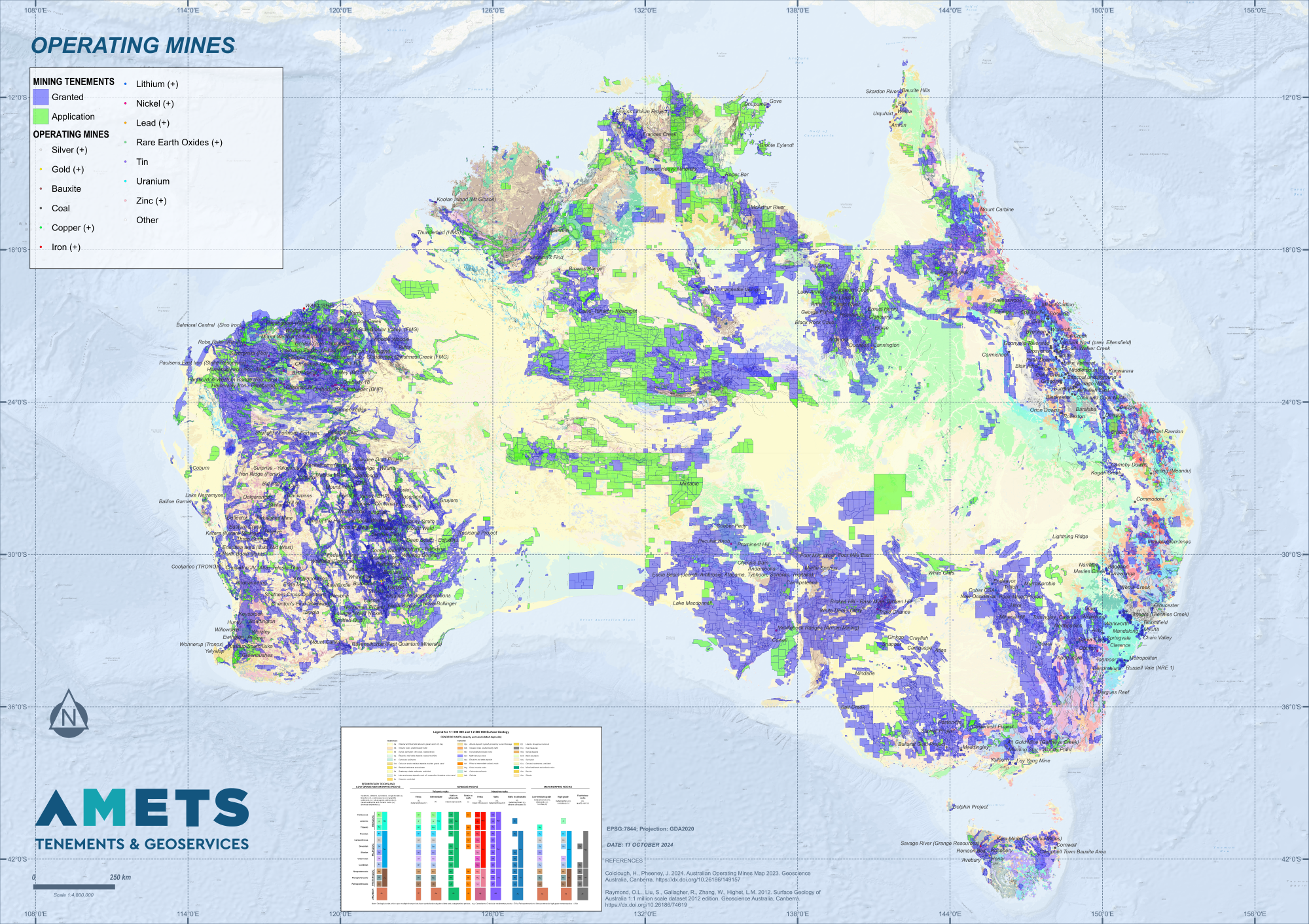
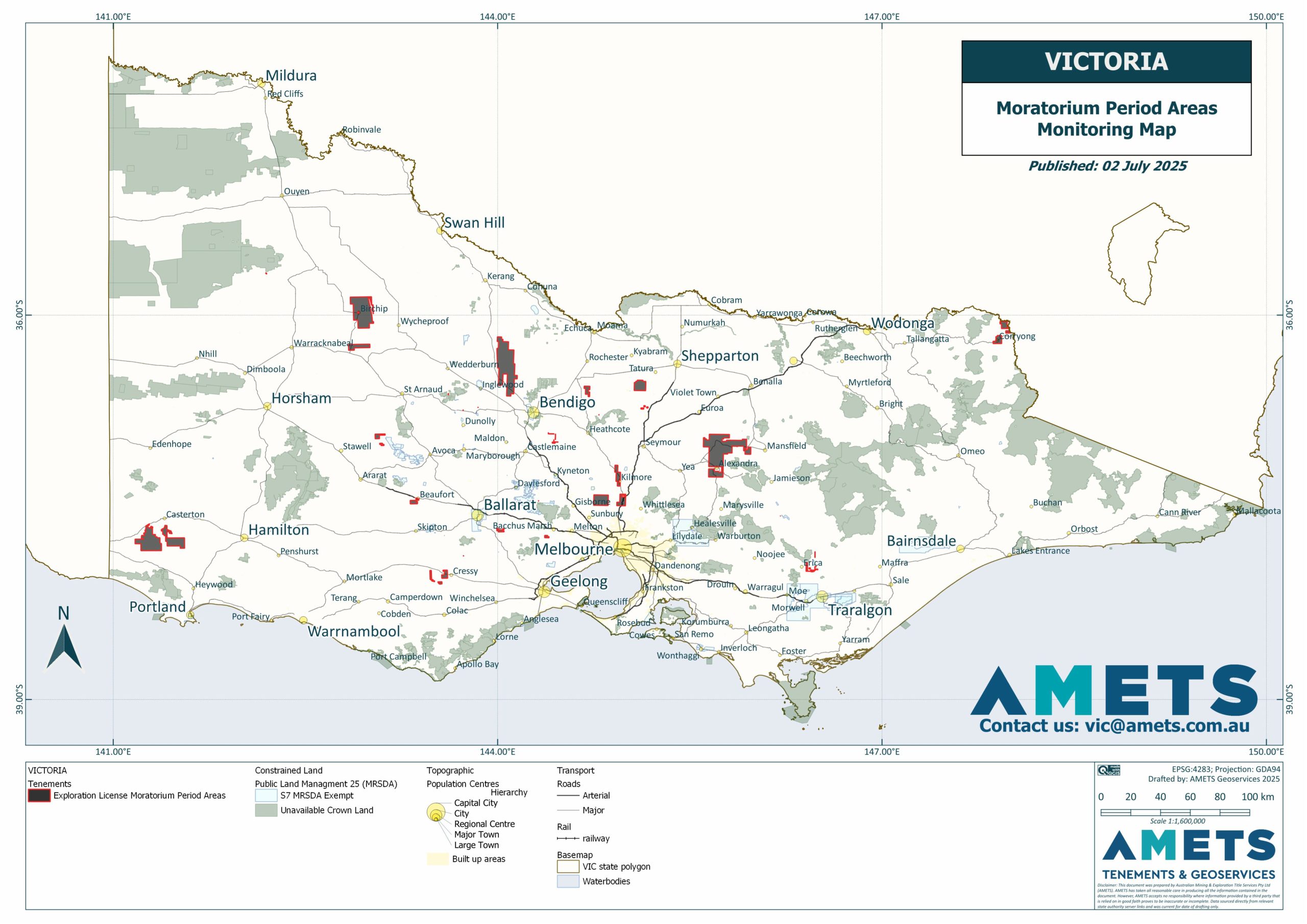
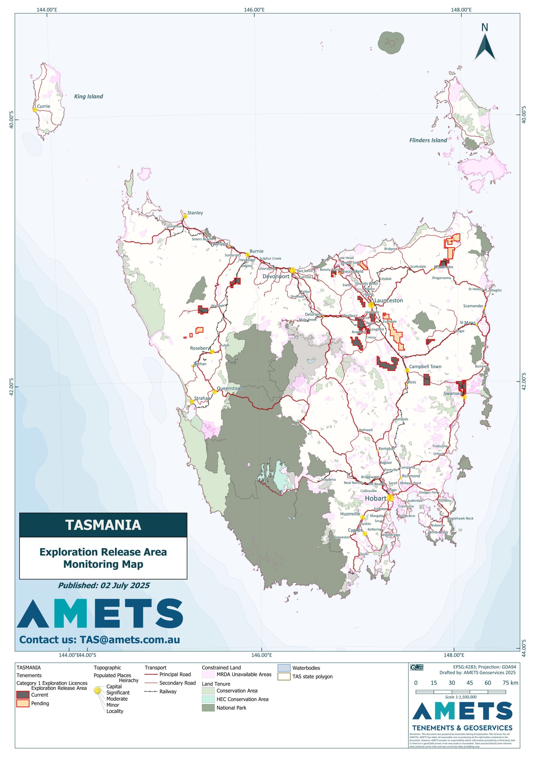
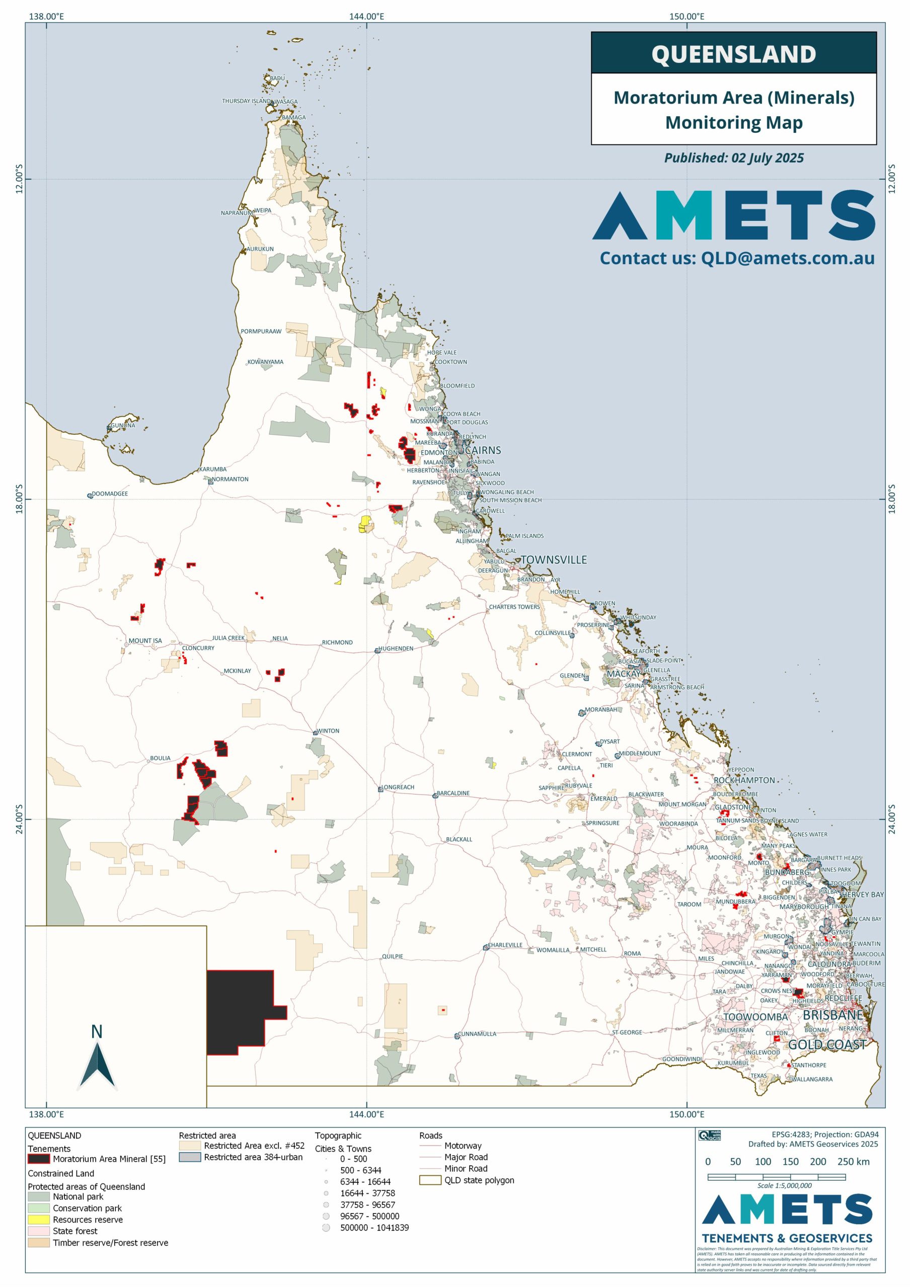
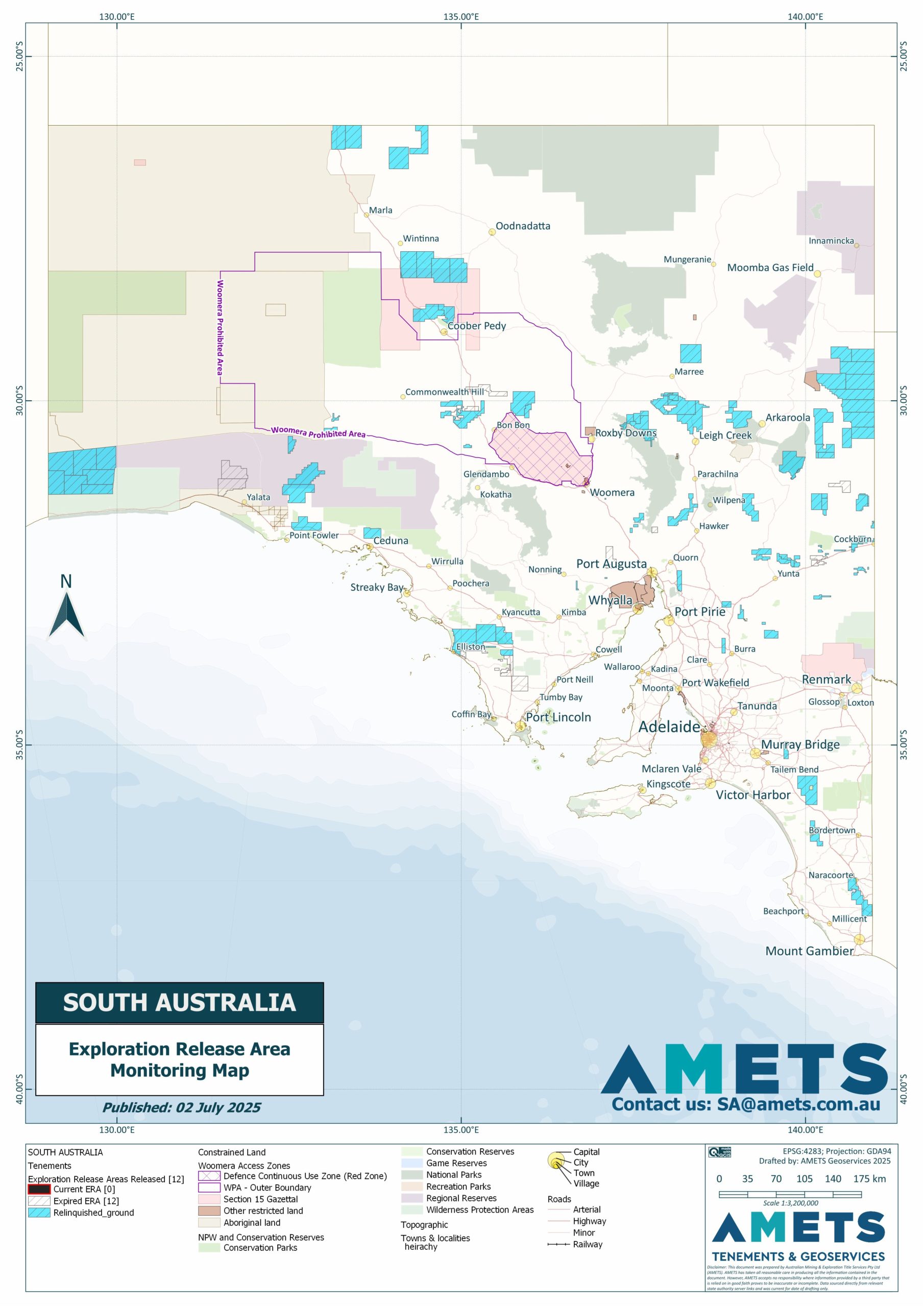
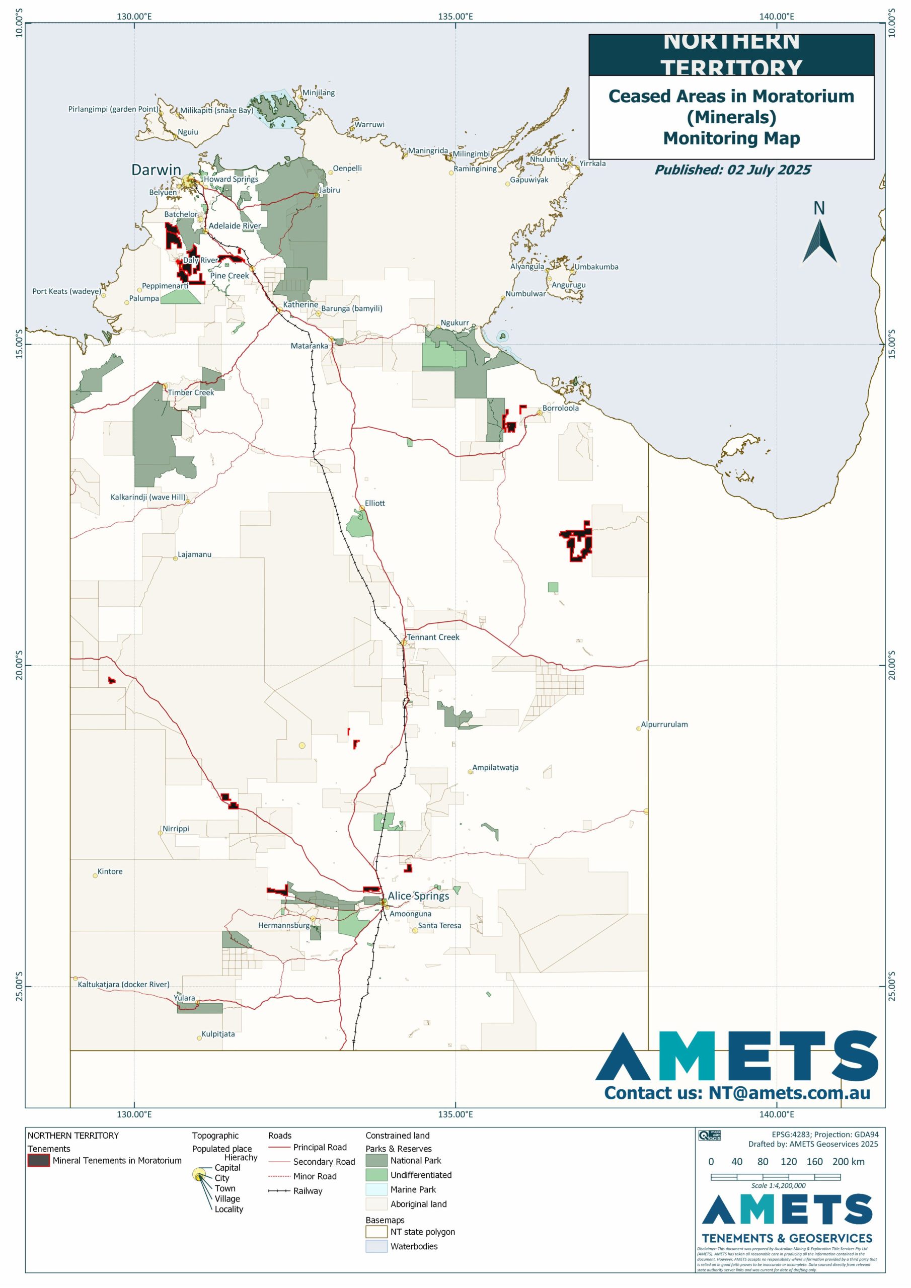
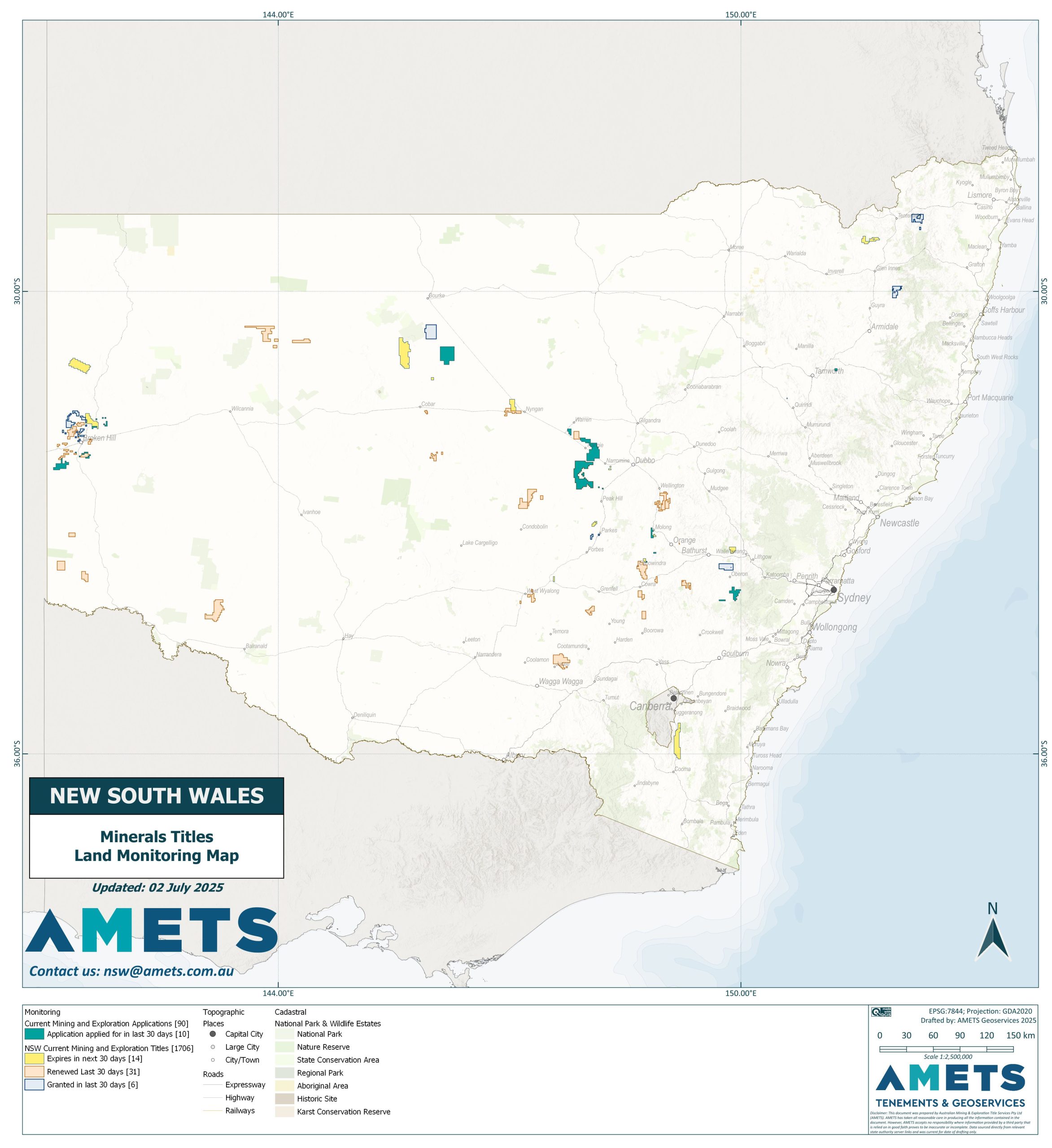
AMETS highly qualified Geoservices Team delivers premium Geographic Information System (GIS) services and cartography, empowering clients to make informed decisions and mitigate risks associated with tenement management, mining, and exploration activities.
Data-Driven Decisions Through GIS MAPPING
Our GIS represents a sophisticated approach to harnessing maps and spatial data, enabling strategic decision-making based on comprehensive intelligence. GIS maps are dynamic and multi-layered, allowing exploration of various information dimensions, providing crucial context for executive-level analysis.
With AMETS as your GIS partner, you’ll be strategically positioned to address any spatial challenge that arises.
Choosing AMETS for your GIS needs means investing in data-driven decision-making backed by robust spatial analysis, enabling efficient resource allocation, saving time and costs.
Visualise patterns and relationships that might otherwise remain hidden.
Data-Driven Decision-Making
Analyse spatial data to uncover trends, identify problems such as overlapping or planned renewables projects, and discover new opportunities.
Efficient Communication
Complex spatial information is communicated effectively through maps and visualisations.
Collaboration
Stakeholders with diverse perspectives can collaborate more efficiently.
get in touch
AMETS comprehensive GIS Mapping services are essential for informed decision-making, risk mitigation, successful project execution and best practice compliance.